Mapping and Charting
Water levels in our nation’s Great Lakes, estuaries, and oceans are always changing. Engineers, surveyors, and shoreline mappers— anyone planning a project near or on the ocean or Great Lakes – must have accurate water level information and common reference points in order to measure elevation relative to the water.
NOAA’s Center for Operational Oceanographic Products and Services (CO-OPS) is responsible for producing and maintaining critical water level data and datums that provide a foundation for many coastal activities, including hydrographic surveys, nautical charting, shoreline mapping, navigation, marine boundary determinations, and dredging.
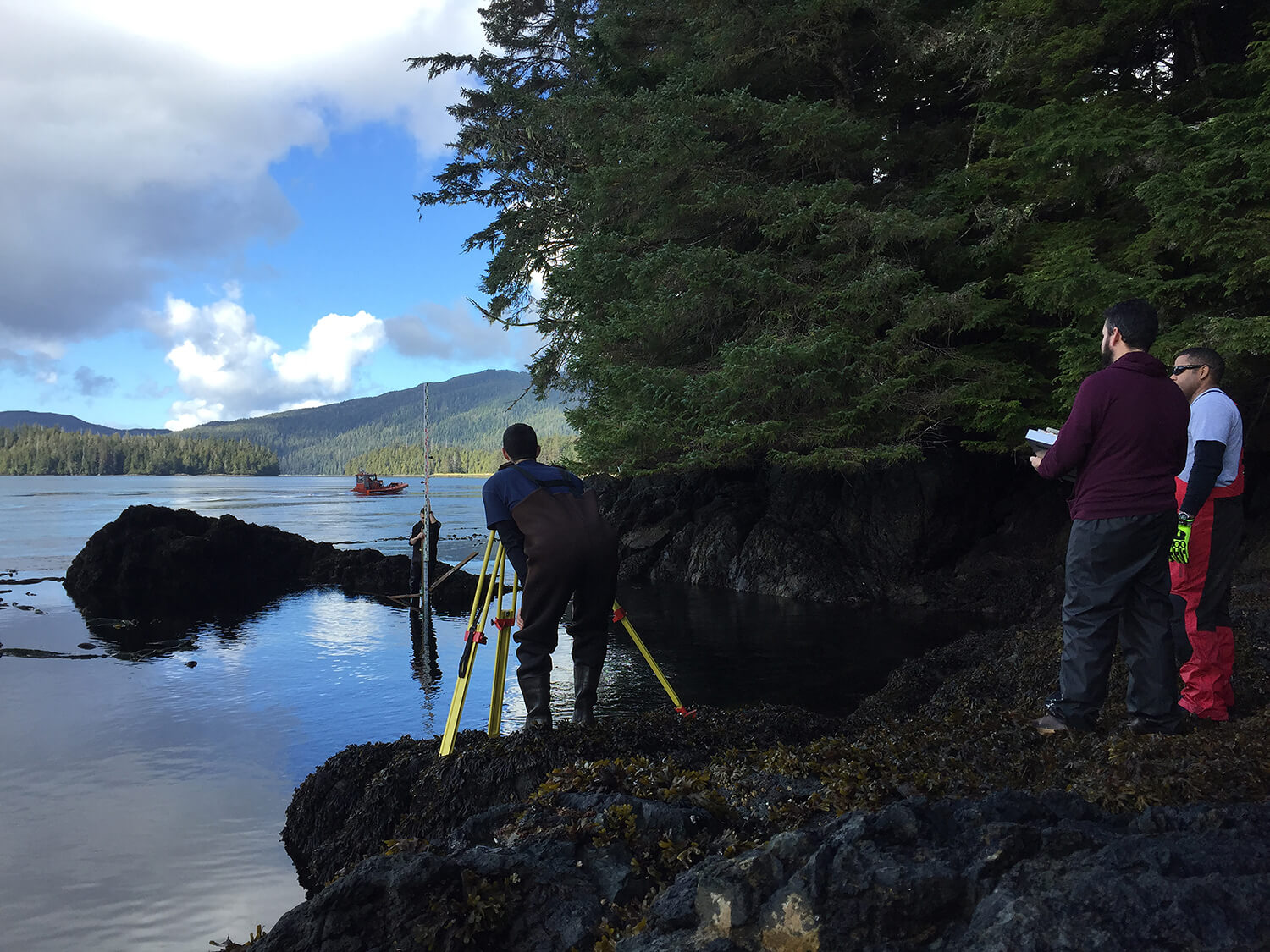
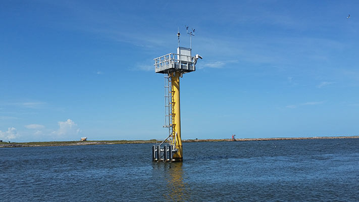
At the core is the National Water Level Observation Network (NWLON), a permanent observing system of more than 200 water level gauges throughout the U.S. and its territories. NWLON is the source for accurate real-time and historical water levels for governments, the commercial navigation sector, and recreational users.
Tidal Datums
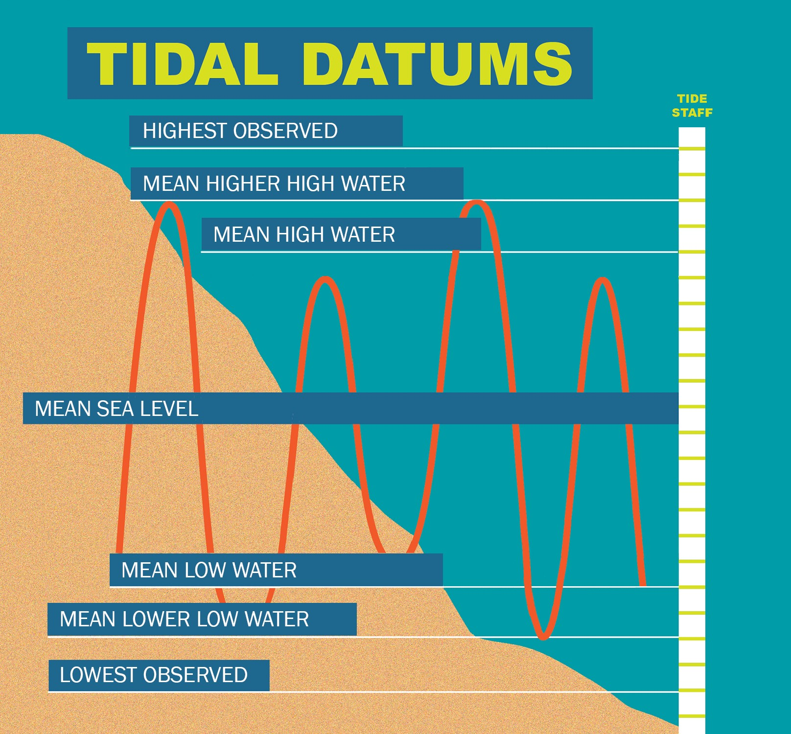
Water level data collected from NWLON must meet rigorous scientific standards because it is used to calculate tide and water level datums, the official vertical reference framework for our nation’s coast. A tidal or water level datum is a reference plane in the ocean or Great Lakes – preserved and accessible through a point on land known as a benchmark – used as the starting point to express local water heights and depths.
CO-OPS oceanographers produce and maintain the Nation’s official tide and water level datums, a highly complex and challenging process. These products benefit everything from NOAA nautical charts to U.S. Army Corps of Engineers infrastructure projects to local marsh restoration, and they serve as the legal basis for marine boundary and shoreline determination.
Additional Mapping and Charting Support Services
VDatum
A free tool designed to convert one type of datum to another, enabling seamless integration of data into a common reference framework, located at vdatum
Nautical Chart Support
Tidal zoning and other oceanographic input for hydrographic and shoreline mapping surveys to ensure vertical control to National Ocean Service standards